Welcome to Eratos
Eratosthenes is best known as the first person to calculate the circumference of the Earth, he was also the Chief Librarian at the Library of Alexandria. We took the name Eratos to pay homage to these two facets of Eratosthenes’ life. We see ourselves as a library of data related to Planet Earth.
This page gives an overview of what Eratos is and does, followed by how the platform creates value for its users.
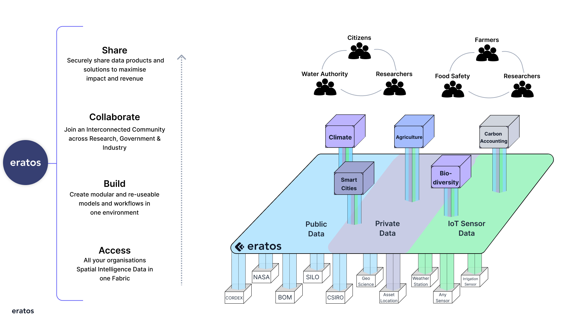
- Eratos is the world’s first spatial intelligence platform for data anywhere, to model anything and share with anyone. Our vision is to transform our world by understanding it and our mission is to bring a deep understanding to the decisions that will create the world we want to live in.
- Creating value lies in building scalable, repeatable solutions that create contextual spatial intelligence.
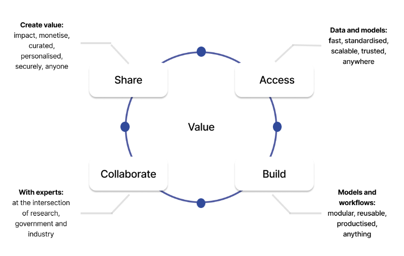
- Value on Eratos is created by applying the following core propositions: access, build, collaborate, share.
Eratos is the world’s first spatial intelligence platform for data anywhere, to model anything and share with anyone. We’ve started with climate and weather. Operating at the intersection of many highly fragmented tools, we are creating an entirely new category that makes any data spatially aware.
Our vision is to transform our world by understanding it and our mission is to bring a deep understanding to the decisions that will create the world we want to live in. This is the first version of our product and we’re constantly improving it. If you have any suggestions on how we can improve your experience please let us know.

Working with data to create solutions or make decisions can often be restrictive, bound by the confines of systems or environments, or requiring expert skills in data management simply in order to access it. So we created Eratos to provide everything you need to create, access, and scale data solutions without the need for specialized skills in data science, geospatial, or software engineering.
Enabling Value Creation
Creating value lies in building scalable, repeatable solutions that create contextual spatial intelligence. Features of the platform include:

Value on Eratos is created by applying the following core propositions:
1. Access
By creating a data mesh of private, public, and IoT data nodes on Eratos, data becomes instantly available because Eratos abstracts away the complexity of connectivity, permissions, governance, and licensing.
2. Build
Eratos makes data spatially aware by transforming it via its modeling and workflow orchestration engine, along the way productizing research and building valuable new IP. The magic is in the modular way products are built so that they are reusable and scalable.
3. Collaborate
Work with domain and industry experts to curate data, build models, design workflows, and integrate into applications and services that are specific to your needs.
4. Share
License data, models, and solutions for others to use for a fee, impact, or for free, letting Eratos manage the sharing and licensing.

Updated 6 months ago
